Best Places to Run in Metro Manila: 6 Free Routes for Every Level

Metro Manila has no shortage of places to run — you just have to know where to go. The best routes are free, open to the public, and spread across Quezon City, Makati, Taguig, Marikina and Manila, so there is a good loop near you wherever you live or work. This guide covers six verified running spots: the distance of each loop, the surface, the best times to go, water and facilities, and how to get there by MRT, LRT or bus. All of them are free to enter.
At a Glance
| Place | City | Loop / distance | Surface | Best for |
|---|---|---|---|---|
| UP Diliman Academic Oval | Quezon City | 2.2 km loop | Asphalt road, tree-shaded | Beginners to advanced; the classic Metro Manila run |
| BGC — Track 30th & Greenway Park | Taguig | 300 m loop; 1.6 km linear park | Paved track and asphalt path | Speed work, lunch-break runs, evening runs |
| Ayala Triangle & Car-Free Sundays | Makati | Around 1 km loop; Ayala Ave closed Sun 6–10 a.m. | Paved paths and closed roads | Office workers, Sunday long runs |
| Marikina River Park | Marikina | Around 11 km riverside route | Paved walkway | Long, flat distance runs |
| CCP Complex & Roxas Blvd Baywalk | Manila | Seaside stretch, flexible distance | Paved promenade | Sunset runs, sea breeze |
| Quezon Memorial Circle | Quezon City | Around 1.8 km outer circuit | Paved paths | Easy morning jogs, families |

1. UP Diliman Academic Oval, Quezon City
The classic. If there is one running route every Metro Manila runner knows, it is the Academic Oval — "Acad Oval" — in the University of the Philippines Diliman campus. The loop is 2.2 kilometres around, almost flat, and lined with acacia trees that give real shade even at midday. One loop is exactly 2.2 km, so tracking your distance is easy without checking your watch.
The Oval is a campus road, so on weekdays you share it with slow-moving cars (one side is reserved for pedestrians and cyclists). On Sundays and holidays it is closed to vehicles, which is when it is at its best — the whole loop belongs to runners, walkers and cyclists. Beyond the Oval, the campus has more to explore: the Science Complex has steeper inclines for hill work, and the famous "Heartbreak Hill" is a short, sharp climb of around 100 metres.
- Distance: 2.2 km per loop
- Surface: Asphalt road, shaded by acacia trees
- Best times: Early morning (5–8 a.m.) and late afternoon; Sundays and holidays for a car-free loop
- Water and facilities: Water vendors and small stalls around the campus; restrooms in campus buildings; the UP Lagoon and Sunken Garden are good cool-down spots
- Getting there: LRT-2 Katipunan station, then a short jeepney or tricycle ride into campus; or MRT-3 Quezon Avenue station, then a jeepney along Elliptical Road. Enter via University Avenue from Commonwealth Avenue.
- Cost: Free
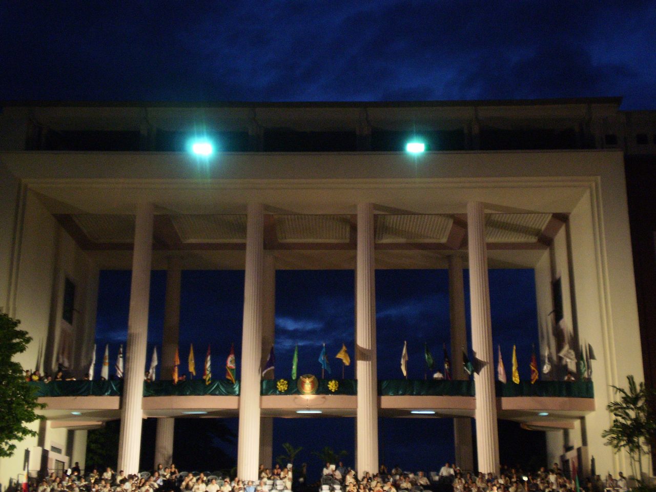
Photo: Rmdelossantos, via Wikimedia Commons — https://commons.wikimedia.org/wiki/File:Quezon_Hall,_UP_Diliman.JPG — Licence: CC BY-SA 3.0
2. BGC — Track 30th and Greenway Park, Taguig
Bonifacio Global City is the most runner-friendly business district in Metro Manila: wide sidewalks, clean streets, good lighting, and plenty of route combinations. Two spots stand out.
Track 30th (on 30th Street) is a small wellness park with a dedicated 300-metre paved jogging loop, plus a yoga lawn and outdoor fitness equipment. It is open daily, roughly 6 a.m. to 10 p.m., and is ideal for short runs, intervals and speed work. Greenway Park is a 1.6-kilometre linear park — one of the longest urban parks in the city — with a continuous, mostly flat asphalt path that is good for a longer, quieter run away from traffic.
The wider BGC street network is also very runnable, especially around Bonifacio High Street, though expect some inclines there — good for leg strength, less good for an easy day.
- Distance: 300 m loop at Track 30th; 1.6 km linear path at Greenway Park; longer loops possible by combining BGC streets
- Surface: Paved track and asphalt paths
- Best times: Early morning and after 5 p.m.; well-lit for evening runs
- Water and facilities: Convenience stores, cafes and malls all around Bonifacio High Street; public restrooms in the malls
- Getting there: MRT-3 Guadalupe or Ayala station, then a BGC bus; or the BGC bus from EDSA. Track 30th is on 30th Street near Lane O.
- Cost: Free
3. Ayala Triangle Gardens and Car-Free Sundays, Makati
Right in the heart of the Makati Central Business District, Ayala Triangle Gardens is a 2-hectare landscaped park with over a hundred trees — acacia, rain trees, golden palms and fire trees — and a loop of a little over 1 kilometre around the gardens. It is the classic lunch-break running spot for people who work in the area: shaded, compact, and surrounded by cafes and restaurants for a post-run coffee.
The bigger draw is Car-Free Sundays: portions of Ayala Avenue are closed to vehicles from 6 to 10 a.m. every Sunday, turning Makati's main avenue into a running and cycling lane. Combine the avenue with the Triangle loop and the nearby Legazpi Active Park (which also has a 300-metre track) for a proper Sunday run.
- Distance: Around 1 km loop in the gardens; longer on car-free Sundays along Ayala Avenue
- Surface: Paved park paths and closed asphalt roads
- Best times: Weekday lunch breaks for a short run; Sunday 6–10 a.m. for the car-free avenue
- Water and facilities: Restaurants and cafes inside and around the park; restrooms in nearby malls (Greenbelt, Glorietta)
- Getting there: MRT-3 Ayala station — the park is a short walk from the station, between Paseo de Roxas, Makati Avenue and Ayala Avenue
- Cost: Free
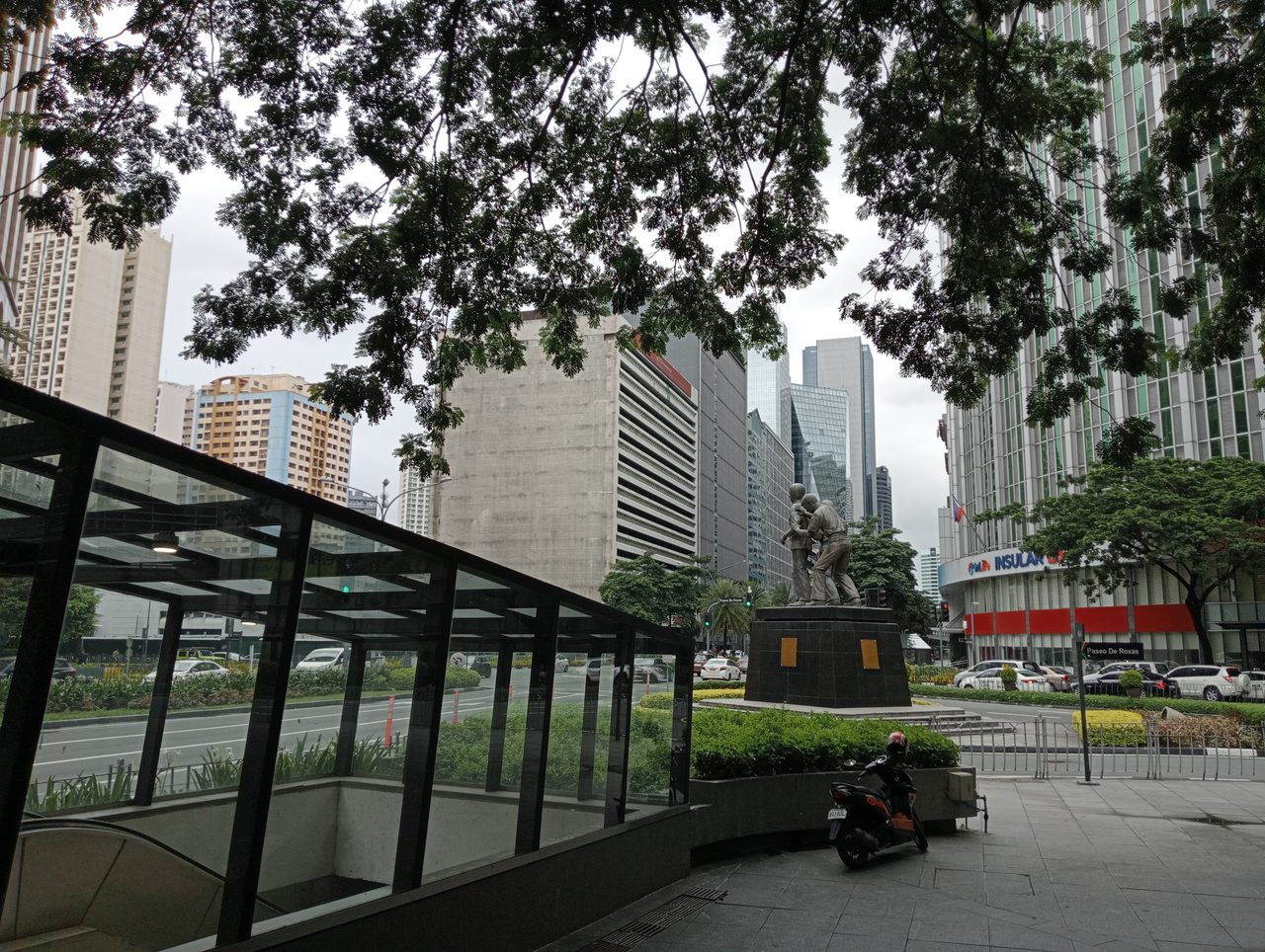
Photo: Ralff Nestor Nacor, via Wikimedia Commons — https://commons.wikimedia.org/wiki/File:Paseo_de_Roxas_and_Ayala_Avenue_Intersection,_Makati_City,_July_2023.jpg — Licence: CC BY-SA 4.0
4. Marikina River Park, Marikina
If you want a long, flat run with fresh air and almost no traffic lights, head to Marikina River Park. The riverside path runs along the Marikina River for around 11 kilometres in total, with gardens, footbridges and bike lanes on both banks. The best-known section is the Riverbanks walkway, around 3.5 kilometres, near the Riverbanks Center mall.
The catch is the heat: there is very little tree cover along the river, so this is a morning route, not a midday one. Bring your own water — there are fewer vendors here than at UP or BGC — and wear sun protection.
- Distance: Around 11 km riverside route in total; around 3.5 km for the Riverbanks walkway section
- Surface: Paved walkway and bike lanes
- Best times: Early morning (5–7 a.m.); avoid 10 a.m.–3 p.m. because of the heat and lack of shade
- Water and facilities: Limited — bring your own water; restrooms and food at Riverbanks Center
- Getting there: LRT-2 Marikina–Pasig station (formerly Santolan), then a jeepney towards Riverbanks Center; or drive — parking is available at Riverbanks Center
- Cost: Free
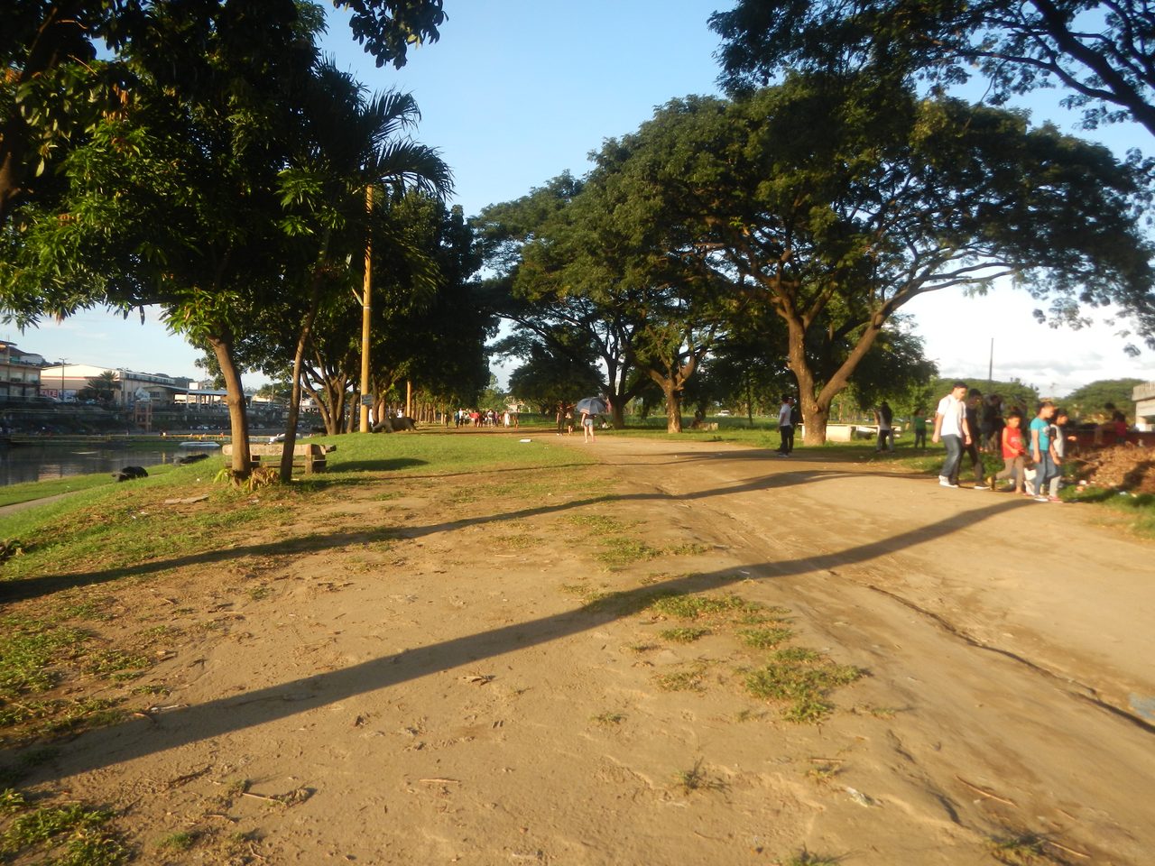
Photo: Judgefloro, via Wikimedia Commons — https://commons.wikimedia.org/wiki/File:0964jf_Marikina_River_Park_fvf_04.jpg — Licence: CC0 (public domain)
5. CCP Complex and Roxas Boulevard Baywalk, Manila
For a run with a sea breeze, the stretch from Quirino Grandstand to the Cultural Center of the Philippines (CCP) Complex along Roxas Boulevard is hard to beat. The Baywalk promenade runs beside Manila Bay, so you get flat, open running and a sunset view if you go in the late afternoon. Running guides list this seaside stretch as one of the recommended routes in Manila, and it is a favourite for weekend fun runs and race events.
This is a flexible, out-and-back route rather than a fixed loop — run as far as you like and turn around. The area around the CCP Complex itself has open grounds and wide roads that are good for intervals when there is no event on.
- Distance: Flexible out-and-back along the Baywalk; the Quirino Grandstand–CCP stretch is a few kilometres each way
- Surface: Paved promenade and roads
- Best times: Late afternoon to sunset (4:30–6:30 p.m.) for the sea breeze and the view; early morning for cooler air
- Water and facilities: Vendors along the Baywalk; restrooms and food at nearby malls and the CCP Complex
- Getting there: LRT-1 Vito Cruz station, then a short jeepney ride or walk towards Roxas Boulevard; or LRT-1 Central Terminal and a jeepney to the CCP area
- Cost: Free
6. Quezon Memorial Circle, Quezon City
The Quezon Memorial Circle is the big elliptical park at the centre of Quezon City, and its outer circuit of around 1.8 kilometres makes a simple, easy-to-follow loop for a morning jog. It is flat, paved, and popular with families, walking groups and beginner runners. Inside the park there are gardens, a museum, playgrounds and food stalls, so it works well as a weekend run-and-breakfast spot.
- Distance: Around 1.8 km outer circuit
- Surface: Paved park paths
- Best times: Early morning (5–8 a.m.); weekends are busy but lively
- Water and facilities: Food stalls and vendors inside the park; restrooms available
- Getting there: MRT-3 Quezon Avenue station — the Circle is right beside the station
- Cost: Free
Tips for Running in Metro Manila
Common Mistakes to Avoid
- Running at noon. Metro Manila heat and humidity are no joke — midday runs are the fastest way to ruin a training week. Go early or go late.
- Assuming every park is runner-friendly. Some parks are small, crowded or mostly grass. The six spots above are the ones with proper loops or long paths.
- Forgetting water on the Marikina route. The river path is long and exposed, with far fewer vendors than BGC or Makati. Bring a bottle.
- Driving to UP Diliman on a weekday and expecting a car-free loop. The Oval is only closed to vehicles on Sundays and holidays. On weekdays, run on the pedestrian side and stay alert.
- Skipping the warm-up. The humidity makes it tempting to start fast, but a 5-minute easy jog first will save your knees and your pace.
FAQ
Where is the best place to run in Metro Manila for beginners?
UP Diliman Academic Oval is the safest bet: a flat, shaded 2.2 km loop, free, and car-free on Sundays. Quezon Memorial Circle (around 1.8 km) is another easy option, especially if you live near MRT-3 Quezon Avenue.
Are these running spots free?
Yes — all six places in this guide are free and open to the public. You do not need a membership or a booking.
What is the best time to run in Metro Manila?
Early morning (5–8 a.m.) or late afternoon (after 4:30 p.m.). The most popular windows are Sunday mornings, when the Academic Oval and Ayala Avenue are closed to cars.
Is it safe to run in BGC at night?
BGC is one of the best-lit and best-patrolled areas in the city, and Track 30th and Greenway Park are popular for evening runs. Still, run with a friend or in busy areas after dark, as you would anywhere.
Can I bring my dog?
Some parks allow pets on a leash, but rules vary and can change. Check the park's current rules before bringing a pet — UP Diliman and Quezon Memorial Circle are generally more pet-tolerant than the BGC parks.
Where can I train for a marathon in Metro Manila?
Combine routes: laps of the UP Diliman Academic Oval (2.2 km each) for measured distance, the Marikina River Park (around 11 km) for a long flat run, and the BGC street network for hill work. For a standard 400-metre track, try the Marikina Sports Center, Rizal Memorial Stadium or PhilSports Arena in Pasig.
Sources
- Inquirer Lifestyle, "Best running spots in Metro Manila" (2026) — Academic Oval 2.2 km, Sunday closures, Marikina River Park 11 km, Car-Free Sundays 6–10 a.m., Greenway Park 1.6 km: https://lifestyle.inquirer.net/579583/best-running-spots-in-metro-manila/
- Takbo.ph, "Best Places to Run Within Metro Manila in 2025" — UP Diliman, BGC, Ayala Triangle, Marikina Riverbanks walkway: http://www.takbo.ph/2025/10/best-places-to-run-in-metro-manila-in-2025/
- BPI, "7 Best Running Spots in Metro Manila" — Track 30th 300 m loop, Greenway Park 1.6 km, Marikina Sports Center: https://www.bpi.com.ph/bestliferun/blogs/best-running-spots-in-metro-manila
- Go for Lokal, "Where to Run in Metro Manila" — distances and free public access: https://www.goforlokal.com/lifestyle/where-to-run-in-metro-manila-best-jogging-running-spots-philippines/
- Vista Residences, "The Top 10 Running Spots for Fitness Around Metro Manila" — Track 30th hours 6 a.m.–10 p.m., Quezon Memorial Circle 1.8 km circuit: https://www.vistaresidences.com.ph/blog/the-top-10-running-spots-for-fitness-around-metro-manila
- University of the Philippines Diliman, "UP Lagoon and the Academic Oval" — Academic Oval 2.2 km, closed to vehicles every Sunday: https://iskomunidad.upd.edu.ph/index.php?title=UP_Lagoon_and_the_Academic_Oval
- Wikipedia, "Ayala Triangle Gardens" — 2-hectare park, opened November 2009: https://en.wikipedia.org/wiki/Ayala_Triangle_Gardens
- Photo 1: Quezon Hall, UP Diliman — Rmdelossantos, Wikimedia Commons, CC BY-SA 3.0: https://commons.wikimedia.org/wiki/File:Quezon_Hall,_UP_Diliman.JPG
- Photo 2: Paseo de Roxas and Ayala Avenue Intersection, Makati City, July 2023 — Ralff Nestor Nacor, Wikimedia Commons, CC BY-SA 4.0: https://commons.wikimedia.org/wiki/File:Paseo_de_Roxas_and_Ayala_Avenue_Intersection,_Makati_City,_July_2023.jpg
- Photo 3: Marikina River Park — Judgefloro, Wikimedia Commons, CC0: https://commons.wikimedia.org/wiki/File:0964jf_Marikina_River_Park_fvf_04.jpg
Last checked: 9 November 2026